GPS
A GPS (Global Positioning System) is a device that uses satellites to determine its position on the earth. This position can be shown on a map within the GPS itself, as well as listed as coordinates that can be exported to GIS software or simply for reference against a paper map. The GPS units used by explorers are the same as those used by fisherman, hikers, and other outdoor users. They are practically the same as auto GPS navigation units but with with more data import/export ability.
It is difficult to overstate how much of a benefit the introduction of GPS was to exploration several decades ago. At every stage of exploration all data, whether sampling points or mapping features, are useless unless recorded with location data. Before GPS, exploration geologists relied on topographic maps to orient themselves in the landscape and then mark down the coordinates from the map's grid. With more detailed exploration work, surveyors used tachometers to create base points as a reference for tape and chain measurements. With the introduction of hand held GPS, geologists were able to record sampling or mapping points to within meters accuracy anywhere in the world in real time. The GPS used in exploration are small hand held units with an accuracy to within around 5m, though the accuracy can decrease under heavy storm cloud or narrow gorges. These stand-alone units are being challenged by apps on smartphones by their ease of use a price. Sampling used in resource estimation should be surveyed more accurately with a DGPS, which can much higher accuracy. |
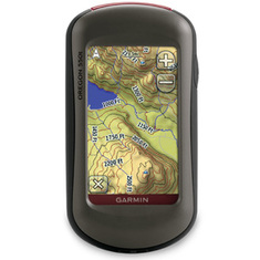
Hand held GPS. Photo credit Garmin Shop.
www.buy.garmin.com
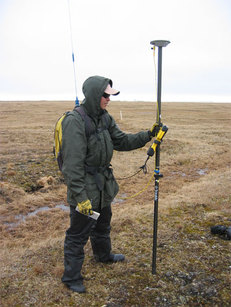
DGPS unit for precision measurements. Photo credit Unavco.
www.facility.unavco.org
|